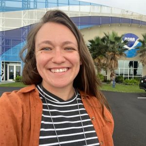
 This World Ocean Month, we sat down with Global Ocean Monitoring and Observing (GOMO) Program Manager Cheyenne Stienbarger to learn more about how ocean observing research can help improve predictions of extreme events.
What is your role in GOMO?
I am a program manager for the Tropical Pacific Observing System (TPOS) and the Extreme Events programs. In this role, I am not the one doing the science, rather, I am supporting the ones who are. I work closely with scientists and other program managers across NOAA, academic institutions, and international organizations on issues related to extreme climate and weather phenomena.
What was your background before this role?
Definitely not oceanography! I have a master’s degree in marine biology from the University of North Carolina, Wilmington (UNCW). My thesis research was the result of a collaborative NOAA Marine Debris Program grant that focused on assessing the consequences of microplastic ingestion across multiple life stages of the Black sea bass. I’ve always been passionate about understanding changes to the ocean and climate, as well as the people who are impacted by those changes. Throughout my master’s program, I quickly discovered that the research/academic path wasn’t the best fit for me. Seeking a different experience that still allowed me to find fulfillment and feel like I was making a positive difference for society, I applied for the John A. Knauss Marine Policy Fellowship – which brought me to NOAA and the GOMO program in early 2020!
What made you choose the Global Ocean Monitoring and Observing Program for your fellowship?
My interest was piqued immediately upon learning about GOMO – especially since our office supports over 50% of the world’s ocean observations, which are necessary for climate and weather prediction models and helping us understand our changing ocean and its impact on the environment. This, along with the major international engagement that comes with being a truly global office, was more than enough to convince me that I would find fulfillment working at GOMO.
As the manager of the Extreme Events program, what interests you about hurricanes and extreme event research?
Hurricanes and other tropical cyclones are among the most destructive weather events on Earth, with negative impacts that are increasingly amplified by warming oceans, rising sea levels, and growing coastal populations – and that disproportionately affects less developed countries and small island developing states. Improved hurricane forecasts serve society by protecting lives and reducing the risk of property damage.
Additionally, only a few months after moving out of the landlocked Midwest to attend graduate school at UNCW, Hurricane Florence directly hit Wilmington in September 2018. Hurricane Florence resulted in the loss of many homes, business, and lives, as well as the destruction of UNCW’s Biology & Chemistry building. This caused millions of dollars in damage, ruined hundreds of irreplaceable samples, and disrupted several months of graduate school for many students, including me. My first and only personal experience with a hurricane has deepened my appreciation for the work with the people who provide observational data for the forecasts, who evaluate the forecasts, and who issue the forecasts. Being able to work with this community directly has been incredibly rewarding for me.
What information is needed to improve hurricane forecasts?
NOAA’s National Hurricane Center has seen a great improvement in the forecasted track of the storms, which is the path a storm will follow before potentially making landfall. While these track forecasts have improved nearly 70% over the last 40 years, forecasts of intensity (the strength of the storm, measured by category level) are still less accurate, particularly when storms rapidly intensify.
Many experts consider that the limited improvement in intensity forecasting is partially attributed to an incomplete understanding of the role of the ocean – today more than 80 percent of the ocean is still unmapped, unexplored and unobserved. Ocean observations have been increasingly acknowledged by scientists as critical to improving the prediction of hurricane intensity. This is part of the motivation for developing the Extreme Events Ocean Observations Task Team and for utilizing ocean observations to improve our understanding of the ocean underneath the tropical cyclones.
Tell us about GOMO’s Extreme Events program.
There is a rich history of expertise across NOAA for hurricane research and forecasting, which has largely focused on the coordination of NOAA aircraft and atmospheric observations. However, the coordination of in situ ocean observations was largely lacking. As a Knauss fellow in mid-2020, I co-organized (alongside Dr. Sid Thurston, another GOMO program manager) the Extreme Events Ocean Observations Task Team (EEOOTT) to provide a unifying organizational infrastructure for NOAA and external partners to coordinate ocean observing efforts related to tropical cyclones and to build a bridge between the ocean observing and modeling communities.
In January 2021, we brought together observing and modeling scientists from across NOAA, other federal agencies, the private sector, and academic institutions for a three day workshop. At this workshop, we created a list of priority recommendations for improving NOAA’s hurricane intensity forecasts using ocean observations. Moving forward with these recommendations will require participation from several scientific communities including ocean observing, meteorology, and modeling across NOAA and external partners.
The EEOOTT consists of about 30 members across NOAA’s programs, labs, and Cooperative Institutes. The team meets regularly during the hurricane season (June 1 – November 30) to coordinate ocean observations across the Mid-Atlantic, Southeast Atlantic, Caribbean, and Gulf of Mexico.
Why are ocean observations important?
According to Frank Marks (the director of AOML’s Hurricane Research Division), “The more we understand about how the ocean fuels tropical storms, the better the forecast will be.” Ocean observations help us improve prediction of weather and extreme events, such as floods, droughts, and hurricanes, monitor changes over time, such as ocean warming, carbon uptake, ocean health, improve maritime safety and navigation, and much more. Ocean observations are conducted using a variety of tools, also called platforms. GOMO and other members of the ocean observing community support several ocean observing platforms that provide relevant information for understanding hurricanes. These include drifters, Argo floats, eXpendable BathyThermographs (XBTs), Saildrones, and underwater gliders.
What are the next steps for the Extreme Events program?
As you may have read, forecasters at NOAA’s Climate Prediction Center are predicting above-average hurricane activity this year – which would make it the seventh consecutive above-average hurricane season. With this in mind, we are planning for a 2023 pilot ‘integrated field campaign’ to provide a coordinated, multi-institutional, and multi-observing platform approach to fully capture many of the ocean features that affect the intensity changes of hurricanes. We will also be working with modelers to integrate ocean observations into the models that predict hurricanes.
It is important to have ocean observations before, during, and after the passage of a hurricane to understand how the ocean affects the storm and how the storm affects the ocean. Coupled with atmospheric observations, ocean observations can improve the representation of the ocean in models that go into forecasts, ultimately helping us better understand how the intensity of hurricanes changes.
Our hope is that with improved observations, we can improve our forecasts and ultimately save lives and property.
See hurricane research in action in the NOAA Ocean Today video Satellites of the Sea: Observing the Ocean for Hurricane Research.


