 So you think you know what’s in the ocean? Even with decades of scientific research, more than 80 percent of the ocean remains unmapped, unobserved, and unexplored – which is a lot considering that more than 70 percent of the globe is covered by the ocean. NOAA’s Global Ocean Monitoring and Observing Program (GOMO) has the distinct mission of supporting ocean observations to improve our understanding of the ocean’s role in environmental change – which is becoming increasingly important as we study climate change.
Through research supported by GOMO and other parts of NOAA, we have made important strides in our understanding of trends in ocean heat storage, carbon dioxide uptake, the Earth’s energy imbalance and more. NOAA supports a suite of ocean observing and monitoring tools (also called instruments or platforms) that make this research possible. Learn about four of these ocean observing tools below – maybe you have already seen some in the ocean!
Argo Floats
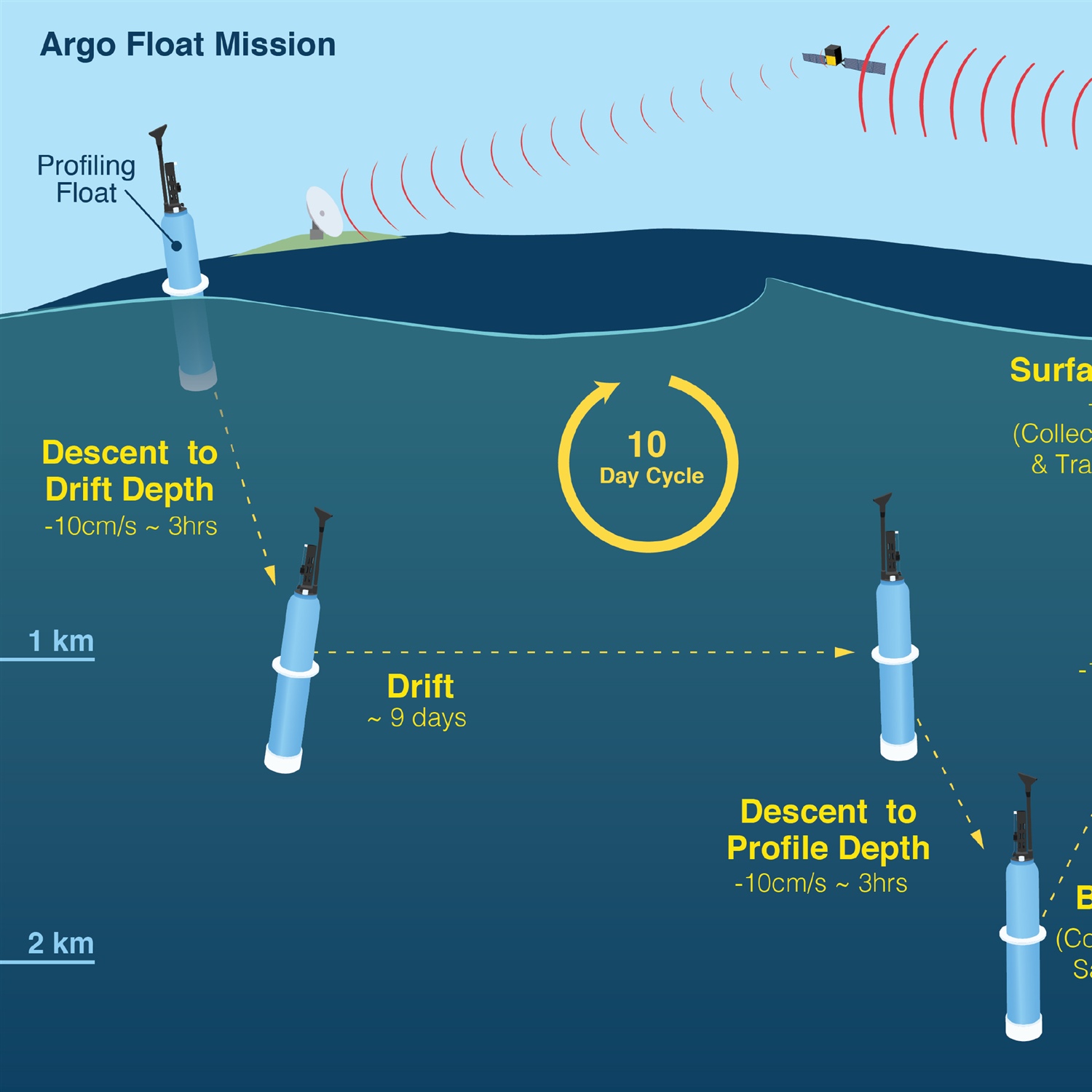
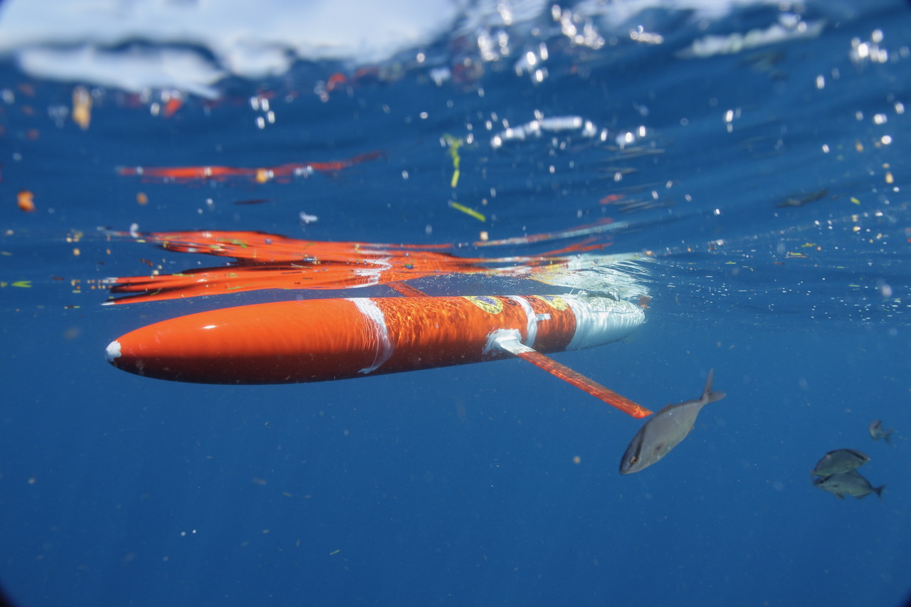
Standing at five feet tall, these robotic, autonomous floats can be found everywhere in the global ocean! In fact, today there are about 4,000 floats globally that drift with ocean currents and are part of the international Argo Program. NOAA led the development of the Argo Program in 1999, which today includes participation from about 30 countries. Argo floats have sensors that collect temperature and salinity data. Every 10 days, floats dive 2,000 meters (1.2 miles) deep, collect data, then resurface to transmit this data to satellites that make it publicly available within hours. Scientists are currently developing floats that can dive even deeper — to 6,000 meters or 3.7 miles below the ocean’s surface — and floats that can measure more variables in the ocean (at 2,000 meters deep) – oxygen, chlorophyll, nitrate, pH, and particle content. These biogeochemical floats will enable scientists to study important marine processes in more parts of the globe than ever before, and to monitor ocean health, which can help improve fisheries management and inform climate policy.
Argo is also used in classrooms in the Pacific Islands to help students understand impacts of climate change. The program Scientific Educational Resources and Experience Associated with the Deployment of Argo profiling floats in the South Pacific Ocean (SEREAD), is an educational program and resource that provides regionally relevant and focused ocean science that is built upon Argo data in a format that fits directly into existing curricula of Pacific Island schools.
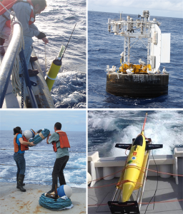
Gliders
Underwater gliders are robotic instruments that collect ocean data over long periods of time. While they are similar in purpose to Argo floats, gliders are much larger and uniquely can be controlled remotely, allowing scientists to alter their paths, which is key for surveying parts of the ocean where other instruments may have drifted away. Gliders generally operate for several months at a time, collecting a suite of ocean data with different sensors. GOMO supports glider observations in the California and Atlantic coasts, regions that are important for understanding ocean processes and improving forecasts. Gliders are particularly important for improving hurricane intensity forecasts, which is a huge research focus area at NOAA’s Atlantic Oceanographic and Atmospheric Lab.
Drifters
Drifting buoys, or “drifters,” are beach ball-sized buoys that you may have seen out in the water. Unlike Argo floats or gliders that dive underwater, drifters float at the surface of the ocean. Drifters can measure temperature, salinity, sea level pressure, wind, currents, and even wave properties. There are currently about 1,300 drifters in the global ocean as part of the Global Drifter Program. GOMO works with the Scripps Langrangian Drifter Lab (LDL) to develop different types of drifters, and NOAA’s Atlantic Oceanographic and Meteorological Lab (AOML) to deploy drifters in scientifically significant parts of the ocean.
Drifters are important observing tools when it comes to studying and predicting extreme events. In 2020, 36 drifters were deployed in front of hurricanes. In 2019, five wave drifters were deployed off Ocean X’s Alucia ship on its way from Miami to Lisbon, Portugal to follow the Gulf Stream and track ocean health. The Gulf Stream is an important boundary current that many countries depend on to transport goods, which makes this a prime location to study waves as they impact ship navigation and maritime safety.
Drifters are also used in classrooms through the Adopt-a-Drifter Program. Students can “adopt” a drifter and then follow its journey in the ocean by tracking its data and learning real life oceanography.
Moored Buoys
If you’ve spent a lot of time in the ocean, you may have come across a gathering of sea lions or seagulls on a structure known as a moored buoy, or mooring. These ocean observing giants are anchored in place and provide a “gold standard” of data because they allow scientists to track changes in the exact same location over long time scales. GOMO supports two main arrays of moorings around the globe: the Global Tropical Moored Buoy Array Program (GTMBA) and Ocean Reference Stations (OceanSITES).
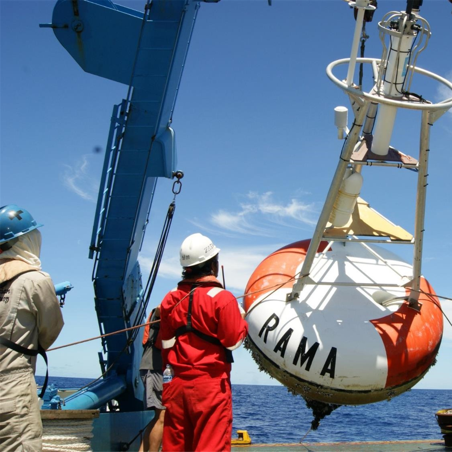
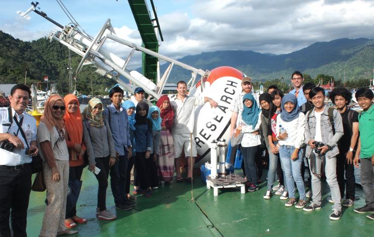
The GTMBA is an international effort to provide data in real-time for climate research and forecasting. It is made up of three arrays: TAO/TRITON in the Pacific, PIRATA in the Atlantic, and RAMA in the Indian Ocean. The Prediction and Research Moored Array in the Tropical Atlantic (PIRATA) Northeast Extension (PNE) studies ocean-atmosphere interactions in the tropical Atlantic that affect regional weather and climate variability on seasonal, interannual and longer time scales. The Research Moored Array for African-Asian-Australian Monsoon Analysis and Prediction (RAMA) studies the Indian Ocean’s role in monsoons and helps improve monsoon forecasts. RAMA also provides an opportunity for capacity development and training of the next generation of oceanographers through workshops supported by the Data Buoy Cooperation Panel.
OceanSITES is another global array of buoys — in this case called ocean reference stations — that measure a variety of ocean health variables and monitor the full depth of the ocean, from the sea surface to 5,000 meters (3 miles) deep. OceanSITES buoys provide high-quality data from long-term, high-frequency observations at fixed locations in the open ocean. The network complements satellite imagery and other observing instruments (like Argo floats). GOMO currently supports seven OceanSITES moorings around the globe, including the Woods Hole Oceanographic Institution Hawaii Ocean Timeseries Site (WHOTS) focusing on trade winds, the Northwest Tropical Atlantic Station (NTAS) focusing on hurricane intensity and the Stratus mooring, which is located off the coast of northern Chile and named after the stratus clouds affect the ocean and atmospheric conditions in the eastern Pacific and impact the climate of this region.
While there is still a lot to learn about the ocean, buoys, Argo floats, drifters and gliders are important tools that are helping us collect valuable data and improve climate and weather forecasts around the world.