
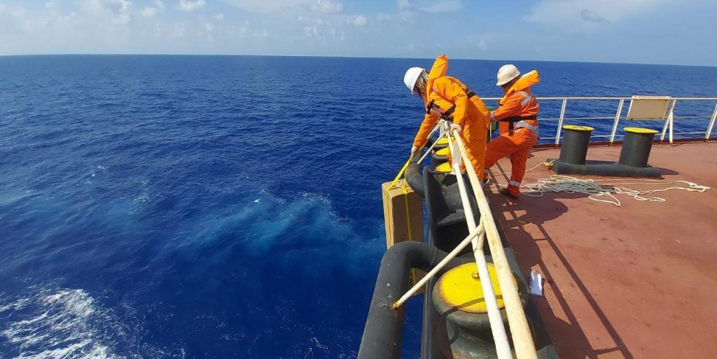
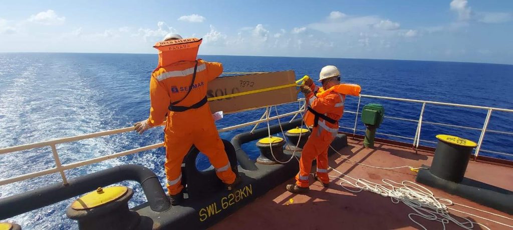
Five autonomous profiling floats were deployed from a commercial vessel into the depths of the Caribbean Sea to improve ocean and hurricane research.
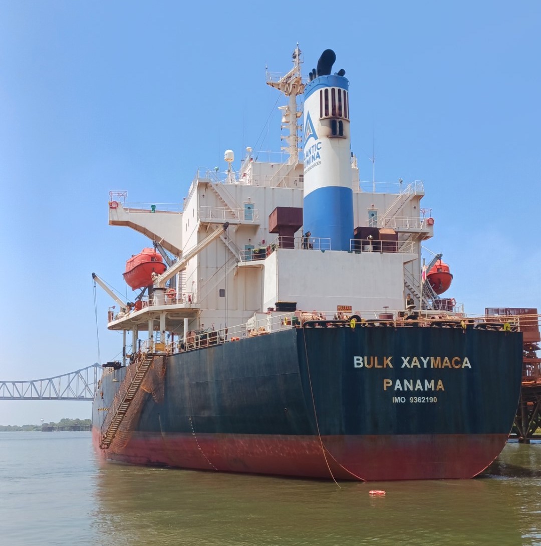
Captain Vassili Pugatsov and the crew of the M/V Bulk Xaymaca, in cooperation with the Argo Float Group at Woods Hole Oceanographic Institution, deployed these ocean observing instruments, known as Argo floats, in early August during a southbound transit from Louisiana to Jamaica. The floats will add to the global Argo array and enhance key ocean measurements in a region critical for accurate hurricane forecasting. The M/V Bulk Xaymaca is a 225-meter-long dry bulk carrier owned by Pangaea Logistics Solutions and operated by Seamar Management S.A.
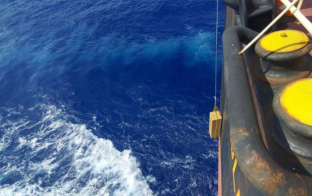
Argo floats are one of the key tools scientists use to collect ocean information, particularly in remote areas. Argo floats are robotic and dive 2,000 meters, or 1.2 miles below the sea surface, capturing temperature, pressure and salinity data that is transmitted to satellites upon their return to the surface every 10 days. In each of these cycles, a profile snapshot of ocean conditions is collected and made available to researchers globally within hours. Ocean observations and data collected from the Argo array are routinely used in climate reports such as the IPCC and serve as one of the foundational methods for measuring ocean heat.
The floats deployed on this cruise have one big difference: they are cycling every five days instead of 10, capturing double the data in order to collect more timely information for forecasters during hurricane season. These ‘fast cycling’ floats were deployed as part of Woods Hole Oceanographic Institution’s contribution to a larger field experiment this 2023 hurricane season sponsored by the Extreme Events Program in NOAA’s Global Ocean Monitoring and Observing Program. The goal of this field research is to improve scientists’ understanding of the role of the ocean, waves, and air-sea interactions in the development and intensification of hurricanes in order to produce more accurate and reliable models and forecasts.
These deployments were possible due to a new initiative called Science Research on Commercial Ships (Science RoCS) where research institutions and industry are joining forces to gather consistent and repeated scientific observations of the ocean and atmosphere. Partnering with Science RoCS has the added benefit of increasing the spatial coverage of the Argo array. The Yucatan Basin has historically been undersampled by Argo floats, creating a ‘hole’ in our coverage of subsurface ocean temperature data. Deploying these five new floats will bolster the fleet and provide coverage for many coming years.
This is the second collaboration between the Argo Program and Science RoCS; the first was in 2021 from a Wallenius Wilhelmsen container ship crossing the North Atlantic. The Argo Program aims to maintain an array of 4,000 floats globally. Teaming up with commercial vessels helps maintain and increase global coverage by providing deployment opportunities in hard-to-reach places, such as in the Indian Ocean and Southern Hemisphere. Through the Global Ocean Monitoring and Observing Program, NOAA contributes to the U.S. and international Argo Program. This mission was coordinated by the Woods Hole Oceanographic Institution, one of NOAA’s Argo partners.
