

Fall in love with science with NOAA pumpkin stencils! (Image Credit: NOAA Education/Kaleigh Ballantine)
NOAA’s Global Ocean Monitoring and Observing Program wants to help you celebrate spooky season in style. Our new pumpkin carving templates highlight some of the ways NOAA measures the ocean and how ocean observations are used.
Grab a pumpkin, check out the stencils below, and download the printable templates to get started with your own ocean observing carving!
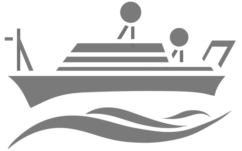
Ships
Many ocean measurements are taken from ships! NOAA conducts several annual cruises through the GO-SHIP program, an international network of 55 global cruise tracks carried out every year since the 1970s. Scientists on these cruises measure a variety of physical, chemical, and biological parameters over the full water column to monitor changes in our ocean over time. NOAA also partners with Ships of Opportunity, which are volunteer commercial and maritime vessels that help collect vital ocean measurements.
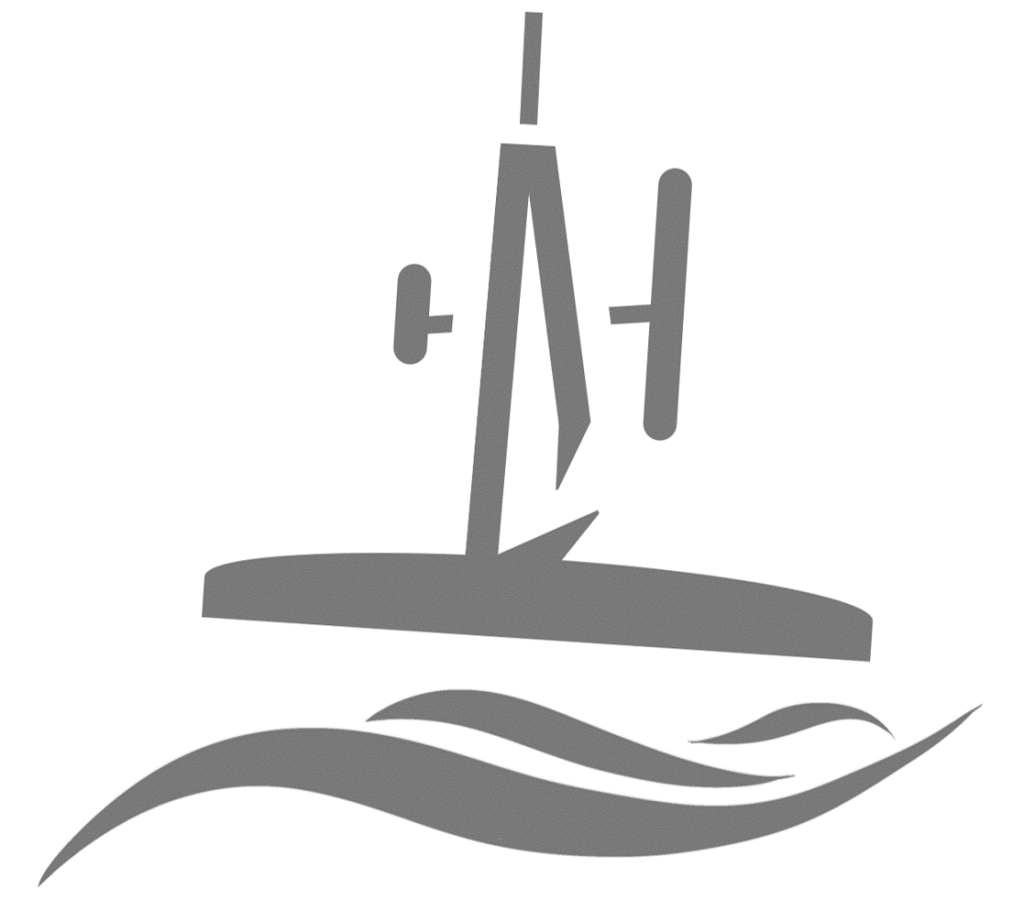
Saildrones
Saildrones are uncrewed surface vessels powered by wind and solar energy that can be piloted by scientists remotely. Equipped with several sensors, Saildrones can take measurements on a variety of ocean variables including wind speed, wave height, temperature, pressure, and salinity. They can be driven over 16,000 nautical miles for up to 12 months at a time, enabling researchers to collect data and carry out “adaptive” or adjustable cruise plans at a fraction of the cost of ships. As an autonomous vessel that can be operated without a crew, Saildrones are able to reach remote and harsh environments like the Arctic and are even helping NOAA collect observations from hurricanes. Check out this footage captured by a Saildrone from inside a hurricane at NOAA.gov!
Argo Floats
Argo floats are underwater robots that help scientists see beneath the ocean surface. Developed over 20 years ago, the Argo Program today supports a global array of nearly 4,000 floats throughout our global ocean. Argo floats drift with the ocean current and collect a profile every 10 days, measuring temperature and salinity from the surface of the ocean down to 2,000 meters. As the Argo float reaches the surface, it transmits its data via satellites in near real-time so that it can be used in research and weather forecasts. New Argo floats are being developed to collect additional measurements like nutrients, pH, and chlorophyll, and to explore even deeper depths. Learn how you can adopt and track your own Argo float through the Adopt a Float Program!

Moorings
While Argo floats and other ocean drifters move with ocean currents, fixed-point moorings collect repeated measurements in the same location. These moorings are typically made up of a buoy or surface marker tethered to an anchor by a line. Scientists can attach sensors and other instruments to the mooring in order to measure characteristics of our ocean or atmosphere. By taking repeated measurements in the same location, researchers can monitor changes in our ocean over time. NOAA maintains many fixed-point moorings through the OceanSITES and Global Tropical Moored Buoy Array programs. One OceanSITES station, “Station Papa,” has measurements extending back nearly seven decades, making it one of the longest ocean data sets in the world!

Hurricanes
Hurricanes are among the most destructive natural disasters. NOAA does a lot of work in hurricane research and monitoring to provide early warnings or “forecasts” so coastal communities can prepare for oncoming storms. To better predict the strength and location of where a storm will make a landfall, NOAA uses a variety of tools to learn how ocean conditions contribute to hurricane development and intensification. Drifters and Argo floats monitor the ocean year-round, while tools like gliders, Saildrones and other technologies can be deployed during hurricane season to collect observations from a storm as it develops.

Check out the NOAA Global Ocean and Monitoring website at globalocean.noaa.gov to learn more about how and why we observe the ocean!
More spook-tacular ocean-themed pumpkin carving stencils can be found on NOAA’s Spooky Science page and the NOAA Sea to Sky: Education resource database, and are available from the NOAA Office of Education, NOAA Fisheries and NOAA SciJinks.
Disclaimer: Pumpkin carving may require the use of knives or other sharp objects. Please carefully supervise children participating in pumpkin carving.
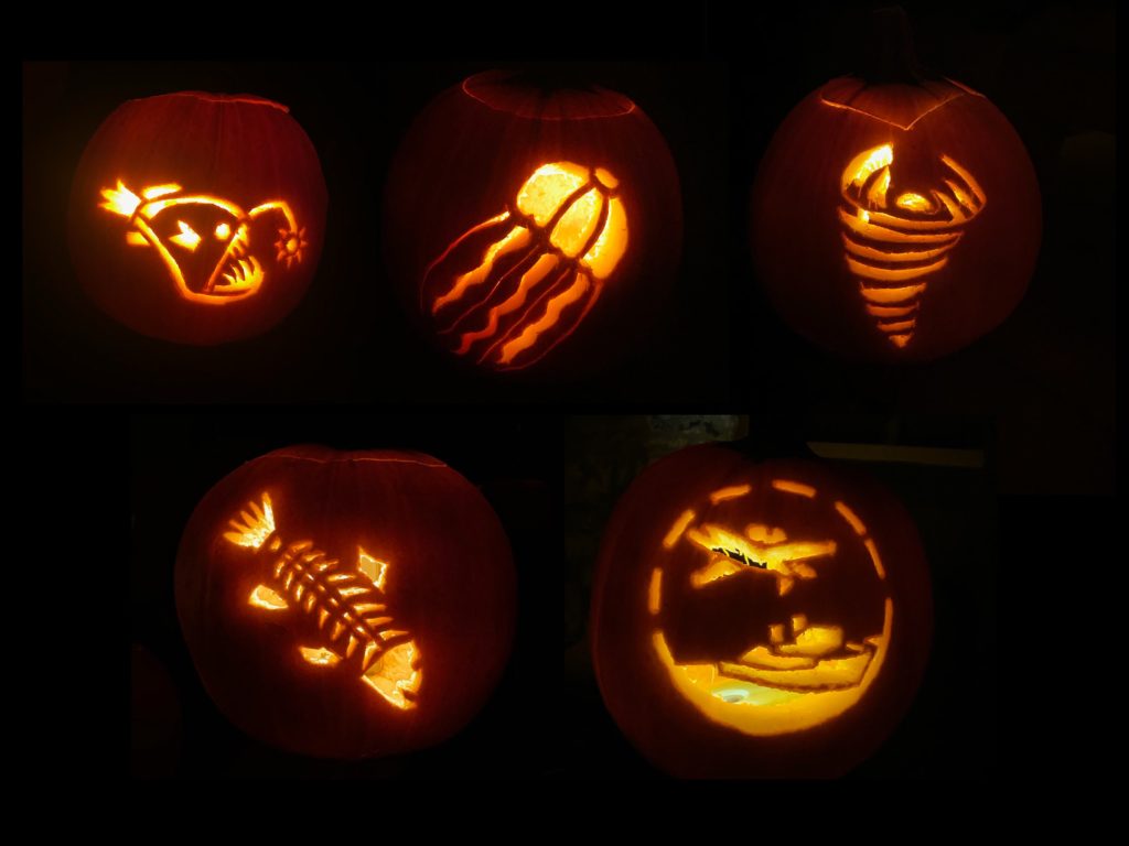
Pumpkins carved by NOAA Office of Education intern Kaleigh Ballantine using pumpkin carving templates Kaleigh created for the office (Kaleigh Ballentine / NOAA Office of Education).