8 Ways to Visualize Argo Data
 The international Argo Program held its 20th Data Management Meeting October 13-18, 2019 in Villefranche-sur-mer, France. The Argo Data Management Team Meeting is a time for the data managers who contribute to Argo to come together and discuss technical matters pertaining to the Argo data stream. For the first time, this meeting included a focus on data visualization and communications, with the goal of helping scientists, educators and the public explore and use Argo data.
Argo floats have been collecting data on global ocean temperatures and salinity since 1999. Today there are about 4,000 of these profiling floats in the oceans worldwide, with program participation from 26 countries. When robotic Argo floats dive below the ocean surface, they collect information on temperature and salinity (and soon will be collecting data on more ocean health indicators), and then transmit this via satellite to the Global Data Assembly Center. This data is mostly used by scientists and researchers who extract the information for models, research, and weather and climate forecasts.
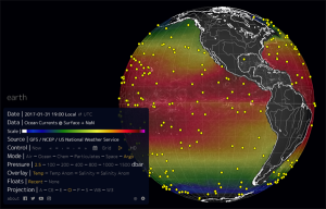
Due to the Argo Program’s wide reach, there are several international programs that have developed engaging data visualization websites that extend beyond the needs of scientists, with some even being used in classrooms. For example, the Earth Null School was created as a way to connect global science and data to every day people and students. During the Argo Data Management Team Meeting, Argo data was added to this data visualization platform, making it readily accessible to the public.
Want to track where in the world Argo floats are and see what data they’re collecting? See the list below and explore some of the exciting ways scientists view and use Argo data:
- If you want to see how ocean currents move in real time across the globe, check out Earth Null School. Used by classrooms to study weather and climate, this data viz site now has Argo information available at this link.
- Find the probability of where an Argo float will travel next using Argovis. This site also has user guides and tutorials to make the site accessible to everyone.
- Compare model results that use Argo data on the Canada OceanNavigator. Stay tuned as this site develops a tool to compare real observations to model data.
- Get a dashboard view of the spatial distribution of Argo floats using Indian Argo Tableau.
- Get technical with the site most used by the scientific community, JCOMMOPS. Click on a float to pull up information like the location where it was last tracked and the latest temperature and salinity measurements.
- Similar to JCOMMOPS, the new Euro-Argo site provides data used mostly by scientists, and is the only site that tracks float battery life.
- Mon ocean et moi (My Ocean and Me) & Adopt a Float are France-based educational projects designed specifically to raise students awareness of ocean science and help students follow floats in the ocean.
- Whether you’re in a classroom or home on your iPad, Argo-France provides a touch-screen friendly site where you can view ocean currents and quickly pull up Argo data by clicking on a float.